Sydney’s secret bushwalks

Bellbird Walking Track, Casula
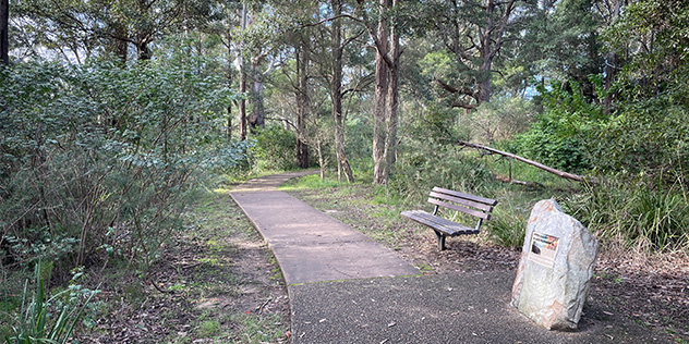
Only a hundred metres from the burr and brawl of the Hume Highway at Casula lies the Bellbird Walking Track, part of Leacock Regional Park.
It’s well-named, with bell miners chiming constantly as you descend the all-weather walkway into the valley. The track forks after a few hundred metres, the left branch terminating at Casula railway station and the right branch becoming the Weaving Gardens Path, which stretches the entire north-south length of Leacock Regional Park.
The hike back up in either case has a fairly steep grade – otherwise it’s not too arduous.
Yeramba Lagoon loop track, Picnic Point
While Cattle Duffers and Fitzpatrick Park on the Georges River have been popular fishing, boating and picnicking spots for generations, the Yeramba Lagoon loop track, on the opposite side of Henry Lawson Drive, is almost invisible.
This one-hour walk circumnavigates the lagoon and infiltrates some thick bush – it’s hard to believe suburban Picnic Point is only a stone’s throw away at times. The addition of a much-needed footbridge at the start/end of the loop has made this walk more civilised, but it still requires a moderate level of fitness.

Salt Pan Creek Reserve, Padstow
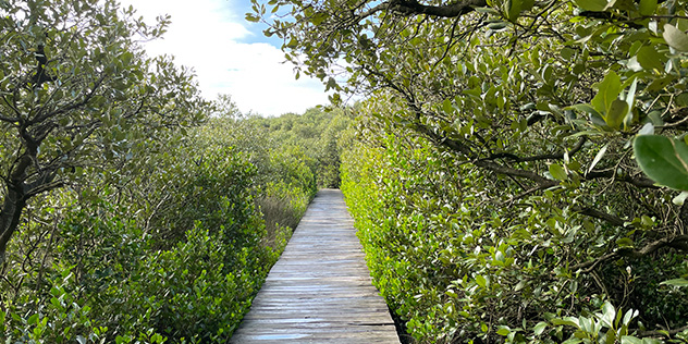
Hidden behind the bustle of Padstow’s industrial estates are kilometres of walking tracks that meander through Salt Pan Creek Reserve’s mangrove ecosystems.
Numerous entry and exit points off Davies Road side-streets mean so you can enjoy a short and peaceful stroll or follow the path across Salt Pan Creek and all the way into Riverwood. The majority of the walk is flat and leashed dogs are welcome.
Beware, as the timber boardwalk section, which is showing its age, can become slippery after rain.
Sugarloaf Loop, Horsley Park
Kicking off at Sugarloaf Ridge, an unexpected spot that offers spectacular views all the way to the Sydney skyline, the Sugarloaf and Moonrise loops are bushwalks through wild scrubland home to fairy wrens, wanderer butterflies and, in the warmer months, the odd snake.
Some sections are hilly, so a reasonable level of fitness is required. As for distance, Sugarloaf Loop is part of the immense Western Sydney Parklands, so your stamina is really the only limit. Access is via Border Road, just off the M7 Motorway.

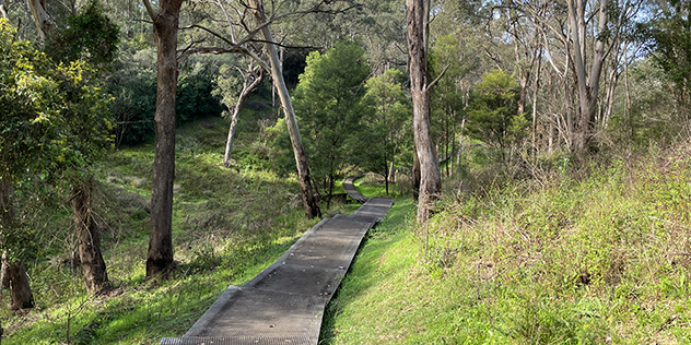
Wolli Creek Walking Track, Earlwood
Just north of the point where two motorways, a main road, and a rail line intersect, you’ll find the entrance to Illoura Reserve, buried at the end of a cul-de-sac in Earlwood’s dense suburban housing.
After a short descent down a rocky path, you emerge on what resembles a meadow, before ascending into jungle-like bushland on a narrow trail. This is the Bray Wetlands Track (according to Google Maps) or the Two Valley Trail (according to the National Parks signpost) – either way, it’s the first leg in a sprawling green corridor that follows Wolli Creek the entire length of Earlwood and joins up with Cooks River in Tempe.
It’s hard to believe you’re nudging up against Sydney’s inner west throughout the entire journey.
Como to Oatley Track, Como
Anyone familiar with the Sutherland Shire has likely visited Como, renowned for its ‘pleasure grounds’ since the late 19th century. Nowadays, its disused rail bridge forms part of the Como to Oatley Track, which kicks off at Como Marina, spans the Georges River, and passes through a tree-lined reserve before emerging at the southern tip of suburban Oatley.
It’s the most civilised walk on this list, with few gradients or obstacles to speak of, and while it’s far from wild, it’s worth doing for the novelty. If you build up an appetite, Blackfish Café and Grill on the eastern side of Como marina has a brekky and lunch menu (and makes superb coffee).

Orange Pye Loop Track, North Rocks
The Parramatta region was one of Sydney’s original colonial outposts, so it comes as no surprise this bushy loop is steeped in history. In the 1800s, the area where it passes alongside Darling Mills Creek was part of a fruit orchard that belonged to landowner James Pye.
In more recent times, Parramatta Council and bush-care teams are restoring it to its natural habitat and it teems with wildlife – during our visit we saw/heard whipbirds, kookaburras, lorikeets and frogs. It’s a short loop but steep in parts, and the track can be rocky and uneven, so wear proper shoes.
You won’t find this walk listed on Google Maps – enter off Speers Road near the Bupa Aged Care facility. If you’re interested in a much longer hike, the Orange Pye Loop converges with the Murri-Yanna Walk, which has recently been upgraded and stretches north all the way to the M2 in Northmead.
Warraroon Reserve, Longueville
While nearby Lane Cove National Park is well known as Sydney’s ‘suburban national park’, this little gem remains more of a local secret.
It roughly follows the vagaries of Tambourine Creek as it wambles towards its junction with the Lane Cove River. The track’s main entry is off busy River Road West, but there are numerous other access points from dead end roads. Expect sandstone cliffs, a natural rock bridge, and plenty of wetland wildlife including egrets, spoonbills and frogs on the 3km return journey.
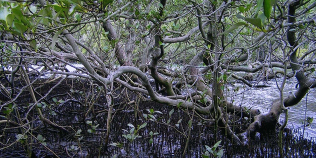
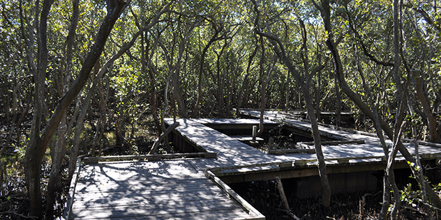
Badu Mangroves, Sydney Olympic Park
Located between Bennelong Pond and Powells Creek, this boardwalk squiggles through the Badu Mangroves, one of the largest wetland areas remaining on the Parramatta River.
Until the 1970s, the marshes in this area were drained to make way for housing and construction, but intensive efforts to return the wetlands to their natural state have seen them flourish again. Information boards offer a guide to the rich biodiversity and if you wish to extend your hike, a bushy path runs north-south along Powells Creek. Access via Bicentennial Drive.